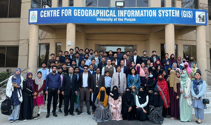
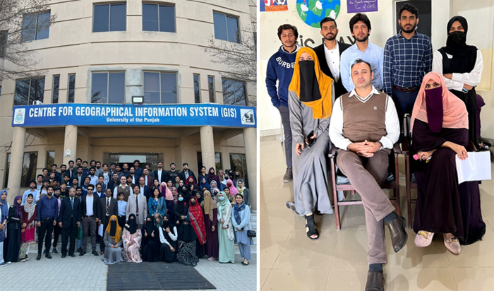
The United Nations designates specific days to celebrate World Wildlife Day, International Day of Forests, and World Water Day, highlighting the importance of these global environmental issues. In continuation of the GIS Talk Series on Emerging Topics in Earth Observation and Spatial Data Science, a one-day workshop was conducted on “ Smart Sensing Nexus for Forestry, Water, and Wildlife” at the Centre for Geographical Information System (CGIS), Faculty of Geo-Sciences, University of the Punjab, Lahore Pakistan. The participants benefited from the discussion on the key concepts and applications of Smart Sensing, Earth Observation, and Geospatial Technologies for Forest, Water, and Wildlife. |
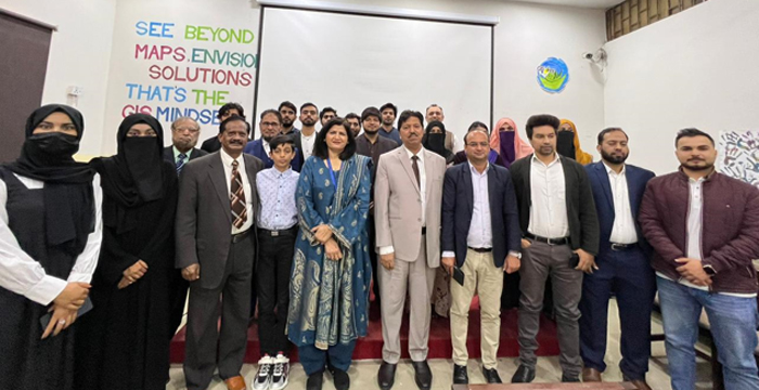
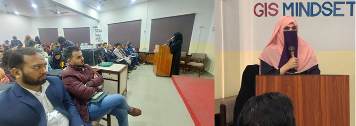
Prof. Dr. Shahid Ghazi, Director of CGIS, emphasized the importance of adopting emerging technologies and the roles of forest, water, and wildlife in everyday life. Dr. Sawaid Abbas, Assistant Professor at CGIS, set the tone by highlighting the significance of embracing new technologies in research and development during his opening remarks. Dr. Samawia Rizwan, Assistant Professor at CGIS, warmly welcomed and thanked our esteemed guest speakers, including Prof. Dr. Ghazala Yasmeen Butt from the Institute of Botany, University of the Punjab, Engr. Muhammad Suleman Khan, Chairman of the Sind Tas Water Council of Pakistan, and Mr. Shahid Malik, GIS Manager at the Punjab Forest Department, for sharing their expertise on emerging challenges in managing Forest, Water, and Wildlife resources. |
|
Experts from the Punjab Forest Department, Sindh Tas Water Council of Pakistan, and Institute of Botany, University of the Punjab emphasized the role of Geographic Information System (GIS) and Smart Sensing Technologies in managing these valuable resources in Pakistan. A diverse group of graduate and undergraduate students from the University of the Punjab, Lahore College for Women University (LCWU), and Government College University (GCU) actively participated in the workshop. |
To equip participants with state-of-the-art technologies and workflows, a hands-on exercise was also conducted on the key concepts and workflows of Object-Based Image Analysis of Drone Images for Tree Cover Extraction, a session facilitated by the GIS Lab of the Punjab Forest Department, Lahore. The GIS Lab team from the Punjab Forest Department, led by Mr. Salman Arshad (GIS Analyst) and Mr. Muhammad Muzamil Khan (Remote Sensing Analyst), provided in-depth technical sessions on Object-Based Image Analysis (OBIA), tree cover classification, and training data compilation. Special thanks to Mr. Shahid Malik for facilitating the workshop and fostering this valuable exchange between academic and industry professionals. |
|
Session details: |
The workshop consisted of two interactive sessions, aimed at providing participants with hands-on experience in Object-Based Image Analysis, followed by talks from the experts and a panel discussion rounds out the session, exploring sustainable management practices and key challenges in these interconnected ecosystems. |
Session 1 |
Opening Remarks: |
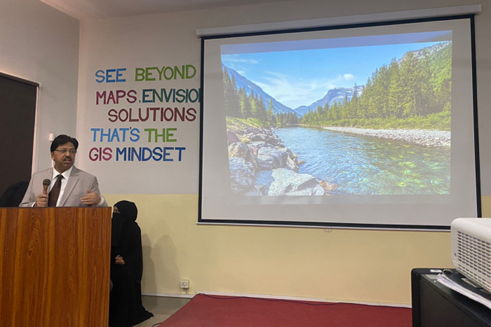
Speaker: Dr Sawaid Abbas, Smart Sensing for Climate and Development, CGIS, PU |
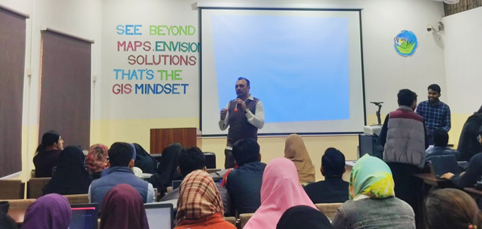
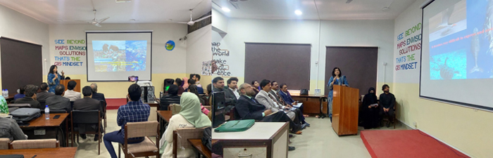
Dr. Sawaid Abbas captivated the workshop audience with his opening, setting the stage for a deeper exploration of the Smart Sensing Nexus. This innovative approach integrates cutting-edge technologies to monitor and manage natural resources effectively, leveraging data from remote sensing, IoT sensors, and GIS for real-time insights into forestry, water, and wildlife management. Dr. Abbas emphasized the importance of embracing such advanced techniques to address environmental challenges and promote sustainable practices in Pakistan. He later delved into fundamental concepts and the paradigm shift in satellite image analysis from conventional pixel-based approaches to object-based image analysis (OBIA). Dr. Abbas highlighted the role, scope, and emerging challenges of OBIA in managing interconnected forest, water, and wildlife ecosystems in Pakistan." |
|
Object-Based Image Analysis of Drone Imagery for Tree Cover Extraction: |
Instructors: Mr. Salman Arshad (GIS Analyst), Muhammad Muzamil Khan (Remote Sensing Analyst), GIS Lab, Punjab Forest Department, Lahore. |
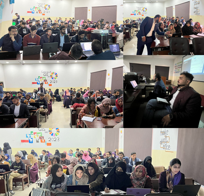
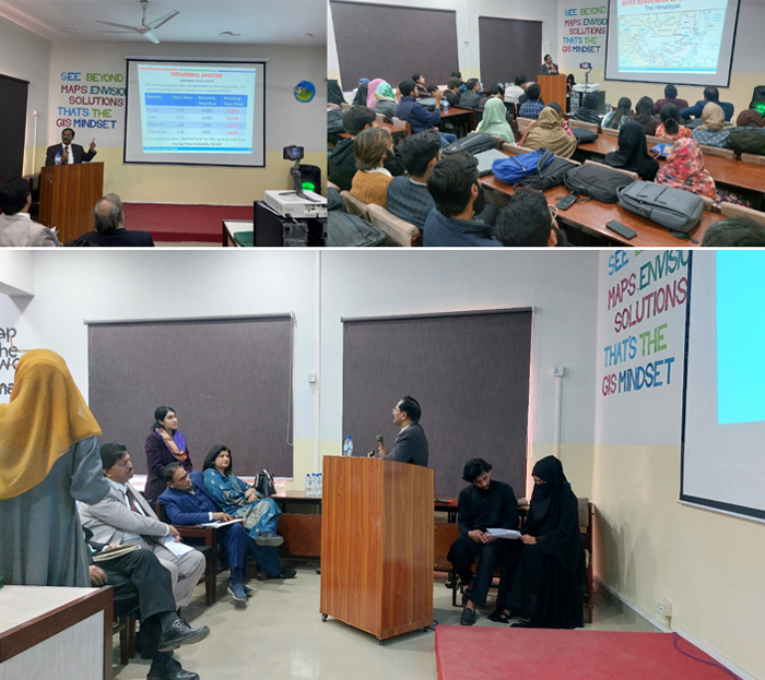
The session of the workshop transitioned from theory to practical application, focusing on object-based and rule-based image classification for tree cover extraction using drone imagery. The session emphasized the importance of "image segmentation", essentially breaking down the image into meaningful objects, like trees, for meaningful image analysis. Participants then delved into two powerful techniques: Nearest Neighbor Classification and Rule-Based Classification. Participants actively created training data and crafted effective rules, all crucial steps for accurate tree cover extraction. The importance of high-quality data was also underscored, as it forms the foundation for reliable drone-based forest analysis. |
|
Session 2 |
Talks and Penal Discussion on Forest, Water and Wildlife Nexus: |
The second session started with the Recitation of the Holy verses of the Quran by Mr. Zahak Wali Zahid and Naat by Ms. Ruqaiya Ahmad |
Welcome Remarks: |
Dr. Samawia Rizwan, CGIS, University of the Punjab |
Dr. Samawia Rizwan warmly welcomed everyone to the International Water, Forestry, and Wildlife Days event. She expressed her gratitude for the diverse audience and highlighted the esteemed group of speakers present. |
|
Keynote Speech 1: Smart Sensing for Wildlife |
Speaker: Prof Dr Ghazala Yasmeen Butt, Institute of Botany, University of the Punjab |
Prof. Dr. Ghazala Yasmeen Butt, a leading voice in ecology wildlife conservation, marvels at the transformation brought about by smart sensing. Key points from her talk included: 1) Gone are the days of expensive, time-consuming methods that offered limited insights; 2) With tools like GIS and remote sensing, wildlife officers can efficiently gather crucial data on populations and habitats of terrestrial and marine wildlife; 3) Newfound knowledge empowers conservation efforts, allowing us to track endangered species, map predator territories, and even analyze pollution threats; 4) The Wildlife department in Punjab, Pakistan, is embracing smart sensing technologies for wildlife tracking and habitat mapping; 5) Smart sensing isn't just a technological leap; it's a revolution, guiding us towards a future where the symphony of life flourishes. |
|
Keynote Speech 2: Water Resources of Pakistan. Water - Environment - Economy |
Speaker: Engr. Muhammad Suleman Khan, Chairman, Sind Tas Water Council of Pakistan |
Engr. Muhammad Suleman Khan, Chairman of the Sind Tas Water Council of Pakistan, outlines the critical challenges facing the nation's water resources. Key points from his talk included: 1) Pakistan, once blessed with abundant water, now facing the challenge of scarcity of water resources; 2) The Indus River sustains the economic engine of the INDO-Pak subcontinent; 3) Jhelum and Chenab rivers are stretched thin by a growing population; 4) International experts warn of Pakistan's precarious position among the top 14 water-stressed countries. Mr. Khan emphasizes the need for a multi-pronged approach. Large-scale projects like the Kalabagh Dam for water storage are crucial, alongside rehabilitation efforts for the Thar, Cholistan, Ravi, and Sutlej rivers. Time is of the essence, warns Mr. Khan. Rising electricity costs threaten the viability of these projects, making sustainable water management a national imperative. |
|
Keynote Speech 3: Integration of Sensing Technologies for Forestry Applications |
Speaker: Mr. Shahid Malik, GIS Manager, GIS Lab, Punjab Forest Department, Lahore. |
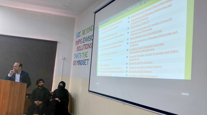
Mr. Shahid Malik shared his experiences and efforts by the GIS Lab of the Punjab Forest Department in adapting innovative approaches for the smart management of forestry resources. Smart sensing technologies are taking centre stage, with Geographic Information System (GIS) and Remote Sensing (RS) forming a powerful duo. The GIS lab of the Punjab Forest Department has integrated sensing technologies in forestry applications including Forest Management Information System, Development of Digital Area Statements, Geo-tagging of Forests using GPS, Digital Mapping of Forest Resources, Forest Change Analysis from Drone and Satellite Images, and Monitoring of Urban and Peri-Urban Forests. The Forest Department's dedication to monitoring and protecting these vital resources is a breath of fresh air for the province. |
|
Closing Remarks: |
Prof. Dr. Shahid Ghazi eloquently concluded the workshop, emphasizing the collective journey towards integrating Geographic Information Systems (GIS) and smart sensing technologies into environmental conservation. His closing remarks captured the essence of the day, marked by insightful contributions from distinguished speakers, who highlighted the critical role of these technologies in understanding, managing, and protecting our planet's vital natural resources. He appreciated the dedicated efforts of the organizers, volunteers, participants, a speakers to make the event a vibrant platform for fostering collaboration and innovation, inspiring all participants to continue their efforts in leveraging advanced technologies for the sustainable stewardship of water, forests, and wildlife. |
|
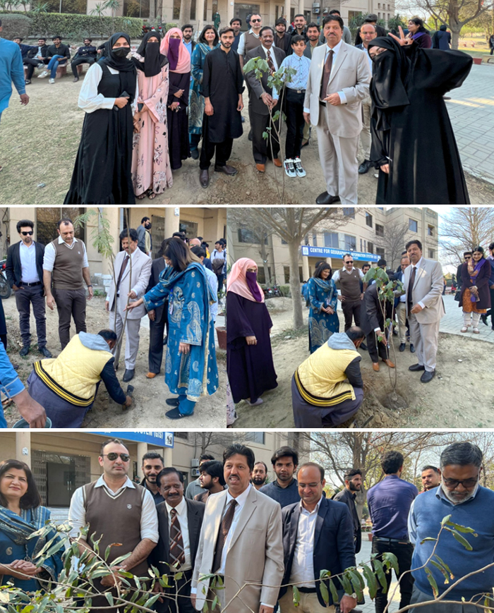
Plantation Activity: |
At the end of the workshop, all the guests and organizers participated in a tree plantation activity. Four trees were planted as a memory of this event and as a promise to adopt smart green technologies in Pakistan. The plantation activity was facilitated by Sunrise Nurseries Farms. |
|
We extend our heartfelt thanks to the Punjab Forest Department team, including Mr. Shahid Malik, Mr. Salman Arshad, and Mr. Muhammad Muzammil Khan, for their invaluable contributions to facilitating the workshop. A special thanks to the speakers Dr. Sawaid Abbas, Prof. Dr. Ghazala Yasmeen Butt, Engr. Muhammad Suleman Khan, for sharing their expertise and valuable insights during the workshop. Their contributions and informative session enriched their understanding of the topic. We sincerely appreciate their time, knowledge, and dedication to promoting advancements in the field. |
We also express our gratitude to Prof. Dr. Shahid Ghazi, Director CGIS, for their guidance and support in making the workshop a success. |
We are also grateful to Dr. Sawaid Abbas, Dr. Muhammad Usman, and Dr. Samawia Rizwan, Assistant Professors at CGIS, for organizing an excellent forestry session within the Smart Sensing for Climate & Development (SCD) program. We also express our gratitude to Prof. Dr. Shahid Ghazi, Director CGIS, for their guidance and support in making the workshop a success. |
A big thanks to the management team, supporting staff, and Smart Sensing Society for their meticulous planning, attention to detail, and seamless execution. A special thanks to Muhammad Waqas, Nawai Habib, Abu Talha Manzoor, Muhammad Burhan, and Talha Afzal, for their hard work and dedication, which made this event a resounding success. Their contributions were invaluable and greatly appreciated. |
We'd like to express our sincere gratitude to our wonderful MCs Ms. Aima Maryam Khizar and Mr. Abdul Hadi, for their exceptional job in keeping the workshop running smoothly. We are grateful for their efforts in bringing together experts, participants, and resources to create a valuable learning experience. |
We are also thankful to Fahad Ali, Fatima Naeem, Muhammad Umar, Ahsan, Wajid, Abdul Hanan, and Sulman Nasrullah for their dedication and involvement. We also acknowledge Zain Imran, Zulfiqar Ali Abbas, Fiza, Jaweria, Farhan Ghani, Syed Aun Abbas, and Fiza Ashraf's role in the workshop's success. We are grateful for their efforts in bringing together experts, participants, and resources to create a valuable learning experience. |
|
Congratulation: |
Congratulations to all participants! Your active engagement and enthusiasm for learning about the nexus of smart sensing techniques for Forest, Water, and Wildlife management were truly inspiring. Your dedication to honing your skills in Remote Sensing and object-based image analysis (OBIA) is commendable. We are confident that the knowledge you gained during this workshop will empower you in your future endeavours and contribute significantly to advancements in the field. |
Event Details: |
Date: 06 March 2024 |
Time: 1000-1600 |
Target Audience: Undergraduate and Graduated Research Students |
Pre-requisite: Basic Remote Sensing and Computer Programming |
Medium of Instruction: English |
Venue: Smart Sensing for Climate and Development Lab, Centre for Geographical Information System, PUCIT, University of the Punjab, Lahore. |
|