Hyperspectral imaging is expanding Earth observation beyond conventional land-cover mapping towards a more detailed understanding of surface composition, vegetation condition and environmental processes. By recording many narrow, closely spaced spectral bands, imaging spectrometers can resolve diagnostic absorption and reflectance features that broader multispectral bands may overlook. These capabilities extend well beyond agriculture and ecology: geological mapping, mineral identification and exploration, soil characterization, mine-waste monitoring, water-quality assessment and the detection of certain atmospheric gases are all important applications of imaging spectroscopy. In vegetation research, the same spectral detail can support the assessment of pigments, leaf water and biochemical properties. The scientific value lies not simply in acquiring more bands, but in linking spectral responses to material properties and environmental processes through appropriate processing, physical modelling and field validation. |
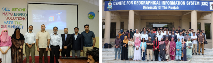
On Wednesday, 21 October 2026, the Smart Sensing for Climate and Development (SCD) research group and the Smart Sensing Society (SSS) organized a hybrid international webinar at the Centre for Geographical Information System (CGIS), Faculty of Geo-Sciences, University of the Punjab, Lahore. Held under the CGIS Talk Series, the webinar, titled “Hyperspectral Earth Observation: From Field Spectra to Crops, Mangroves, Vegetation Function and Cities,” brought together researchers working across field spectroscopy, UAV observations, spaceborne hyperspectral imaging and environmental applications. The central theme was the scientific connection between spectral measurements and their interpretation across observation scales—from individual leaves and field plots to satellite image pixels. |
The webinar illustrated how hyperspectral imaging complements established multispectral Earth observation systems such as Landsat and Sentinel-2. The five technical talks focused on crop spectral libraries, mangrove species and leaf condition, solar-induced chlorophyll fluorescence, greenhouse-gas retrieval and land-cover characterization in coastal and urban landscapes. The wider imaging-spectroscopy context also encompasses geological mapping, minerals, soils, water and atmospheric applications. Throughout the session, a recurring message was that spectral richness alone is insufficient: atmospheric correction, calibration, spatial scale, reference measurements and fit-for-purpose retrieval models are essential for credible interpretation. |
|
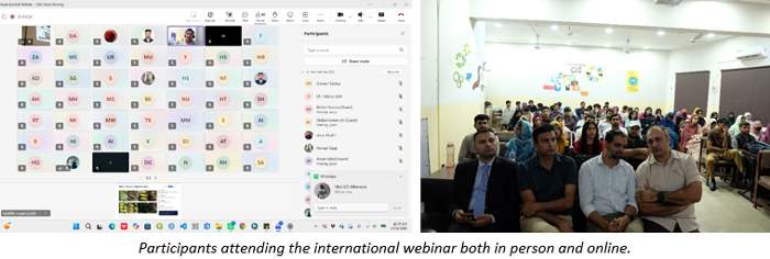
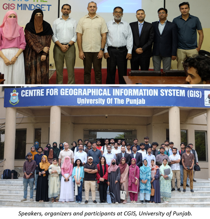
Five speakers from academic, research and government institutions contributed to the technical programme: Dr. Danish Raza, Dr. Majid Nazeer, Dr. Syed Muhammad Irteza, Mr. Muhammad Umar and Ms. Nawai Habib. Dr. Majid Nazeer and Mr. Muhammad Umar participated remotely through Microsoft Teams, while the remaining speakers delivered their presentations at CGIS. Students, researchers and professionals attended in person and online, supporting exchange across disciplines and institutions. |
|
Opening Remarks: |
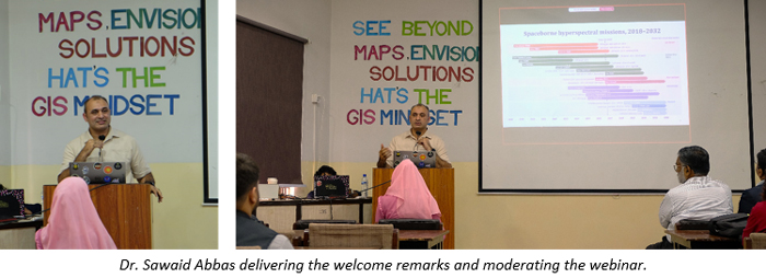
The session opened at 10:00 a.m. with welcome remarks by Dr. Sawaid Abbas, Assistant Professor at CGIS and Research Lead of Smart Sensing for Climate and Development, who also moderated the webinar. He introduced hyperspectral imaging as a scientific approach for examining not only what is present on the Earth’s surface, but also its material composition, condition and functioning. Alongside agriculture, forest health and coastal ecosystems, he highlighted applications in geological and mineral mapping, mining-related environmental monitoring, soils, water quality and atmospheric-gas detection. His introductory presentation surveyed the evolution of spaceborne imaging-spectroscopy missions, the trade-offs between spectral, spatial and temporal capabilities, and examples from Earth-system research. He encouraged students and early-career researchers to connect satellite imaging with field spectroscopy, robust physical interpretation and rigorous validation. |
|
| Session Insights: |
| Talk 1: Field Spectra to Satellite Crop Monitoring |
Speaker: Dr. Danish Raza, The Urban Unit (P&D Board, Punjab); Visiting Faculty, CGIS. Dr. Raza is the developer of CROPSPECPK, a crop spectral library for Pakistan. |
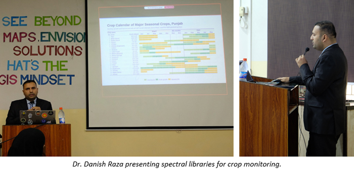
Dr. Danish Raza introduced the use of field spectroscopy and crop spectral libraries as reference information for satellite-based crop identification and monitoring. Drawing on CROPSPECPK, a spectral library developed for crops in Pakistan, he discussed how differences in spectral response can support crop discrimination and interpretation of plant condition. He highlighted the red-edge region, which responds to changes in vegetation pigments and canopy characteristics, and shortwave-infrared absorption features associated with water and biochemical constituents. His presentation underscored the importance of representative field spectra and suitable spectral matching when transferring measurements from leaves or plots to satellite observations. |
|
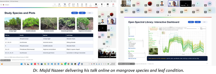
Talk 2: Mangrove Species and Leaf Condition through Hyperspectral Imaging |
Speaker: Dr. Majid Nazeer, Research Assistant Professor, Hong Kong Polytechnic University (online via Microsoft Teams). His work focuses on remote sensing and artificial intelligence for coastal areas. |
Dr. Majid Nazeer explored the potential of hyperspectral imaging to distinguish mangrove species and assess leaf condition in coastal forests. He described the use of field spectroradiometry and UAV-based spectral observations to characterize vegetation reflectance and build reference information for species mapping. The presentation highlighted how linking field measurements with airborne and satellite imagery can strengthen coastal habitat assessment, while also drawing attention to the challenges posed by mixed pixels, canopy structure and differences in observation scale. |
|
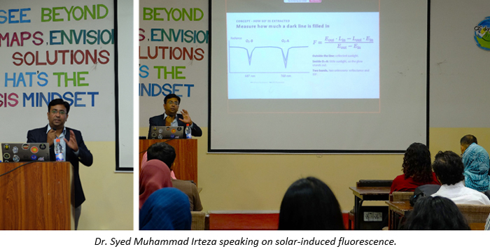
| Talk 3: Solar-Induced Fluorescence from Field and Satellite Spectra |
Speaker: Dr. Syed Muhammad Irteza, Punjab Information Technology Board (PITB). His research includes the retrieval of solar-induced chlorophyll fluorescence from field spectra and Hyperion imagery. |
Dr. Syed Muhammad Irteza discussed solar-induced chlorophyll fluorescence (SIF), a weak radiative signal emitted by chlorophyll that can provide complementary information about photosynthetic processes. He explained the spectral basis of fluorescence retrieval from field measurements and hyperspectral observations, including work involving Hyperion imagery. In contrast to conventional reflectance indices, which primarily describe canopy optical properties, SIF can contribute information about vegetation functioning, although its interpretation requires careful treatment of atmospheric effects, illumination conditions and retrieval uncertainty. |
|
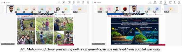
Talk 4: Hyperspectral Retrieval of Mangrove Greenhouse Gases via Physics-Based Radiative Transfer Modelling |
Speaker: Mr. Muhammad Umar, PhD candidate, Hong Kong Polytechnic University (online via Microsoft Teams). His research focuses on spaceborne spectroscopy and radiative transfer. |
Mr. Muhammad Umar presented a physics-based radiative-transfer approach to investigating atmospheric greenhouse-gas signals over mangrove and coastal wetland environments using spaceborne hyperspectral observations. He described the BC-FRT modelling framework and the use of spectral absorption information relevant to methane (CH₄) and carbon dioxide (CO₂). The presentation opened an important discussion about what can be inferred from satellite-retrieved atmospheric concentrations and the additional evidence needed to attribute observed signals to wetland sources. Such retrievals should not be interpreted as direct measurements of mangrove gas fluxes without appropriate atmospheric modelling and independent validation. |
|
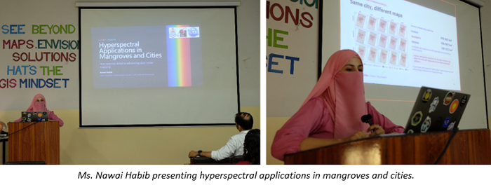
Talk 5: Hyperspectral Applications in Mangroves and Cities |
Speaker: Ms. Nawai Habib, Researcher, Smart Sensing for Climate and Development (SCD), Centre for Geographical Information System (CGIS), University of the Punjab. |
Ms. Nawai Habib examined the use of hyperspectral imagery for land-cover characterization across mangrove and urban environments. She discussed PRISMA observations alongside established Landsat and Sentinel-2 datasets, highlighting the potential of narrow spectral bands to improve discrimination among classes with similar broadband responses. The presentation emphasized opportunities for combining complementary sensors while recognizing that spatial resolution, image acquisition dates and classification validation can strongly influence results. |
|
| Discussion and Closing: |
A moderated discussion followed the five presentations from approximately 11:30 to 11:55 a.m. Participants attending at CGIS and through Microsoft Teams engaged with the speakers on spectral reference libraries, cross-sensor interpretation, vegetation indicators and the reliability of spaceborne retrievals. The exchange reinforced the importance of matching imaging capabilities and analytical methods to well-defined scientific questions. |
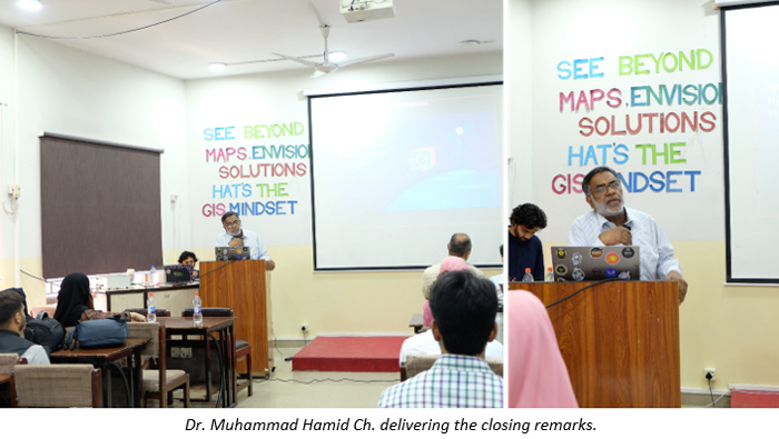
The webinar concluded with remarks by Dr. Muhammad Hamid Ch., Incharge of CGIS, who thanked the speakers, participants and organizing team. He emphasized the importance of sustained research collaboration and capacity development in hyperspectral imaging and related Earth observation technologies. |
|
|
| Acknowledgement and Congratulations: |
The organizing team sincerely thanks Dr. Danish Raza, Dr. Majid Nazeer, Dr. Syed Muhammad Irteza, Mr. Muhammad Umar and Ms. Nawai Habib for sharing their research and technical insights. Their presentations connected field spectroscopy, hyperspectral imaging and environmental interpretation across agricultural, coastal and urban applications. |
We also acknowledge Dr. Sawaid Abbas for coordinating and moderating the webinar and for introducing the wider scientific context of imaging spectroscopy, and Dr. Muhammad Hamid Ch. for his support and closing remarks. |
We extend special thanks to our colleagues Dr. Samawia Rizwan (CGIS), Dr. Adeel Ahmad (Institute of Geography and GeoScape Analytics Lab, GSAL), and Dr. Muhammad Asif Javed (College of Earth and Environmental Sciences, CEES), University of the Punjab, for their presence and collegial support. Special appreciation also goes to the Smart Sensing Society and its organizing team for event coordination and technical arrangements. We thank Muhammad Burhan, Umm e Habiba, Mati Ur Rehman, Gohar Ali and Noor Hassan for their contributions to the successful delivery of the hybrid session. |
We thank all participants for their thoughtful questions and active engagement. The webinar highlighted opportunities for future collaborative research, practical training and locally validated applications of hyperspectral imaging in Pakistan. E-certificates were available to participants upon request. |
| Event Details: |
| Date: |
Wednesday, 21 October 2026 |
| Time: |
10:00 am – 12:00 pm PKT |
| Mode: |
Hybrid (in person at CGIS and online through Microsoft Teams) |
| Target Audience: |
Undergraduate and graduate students, researchers and professionals |
| Medium of Instruction: |
English |
Venue: |
Centre for Geographical Information System (CGIS), University of the Punjab, Lahore, Pakistan |
|